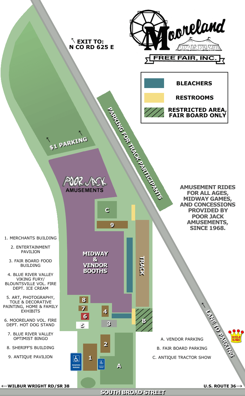
Midway Map

Merchants Building
* Queen & Princess Voting Booth* Fair T-Shirts (Karemar Booth)
* 4 Rows of Vendors
* Veteran's Service (Flag Pole)
Entertainment Pavilion
* Indoor Stage* Seating Provided
Fair Board Food Building
* Indoor Dining* Limited Outdoor Dining (Perimeter)
* Popular Hang Out Spot Out Front
BRV Fine Arts / Blountsville Vol. Fire Dept.
* Outdoor Dining Available (Both Sides)* Fair Board Bleachers Nearby
* Hagerstown FFA Lemon Shake-Ups Nearby
White Building
* Art, Photography, Floral Room* Home & Family Exhibit Room
Mooreland Vol. Fire Dept. Hot Dog Stand
* Outdoor Dining (Covered Porch)
BRV Optimist Bingo
* Seating Provided (Outdoor Perimeter)
Sheriff's Building
* Outdoor Limited Seating (Covered Porch)
Antique Pavilion
* Ham & Beans "Tent"(Limited Indoor Dining & Many Outdoor Dining Tables)
* 2 Rows of Vendors
Hospitality Tent
* Located Along Track Side of the Midway* Shaded/Covered Outdoor Seating
* Diaper Changing / Nursing Mom's Facilities Available
* Free Cold Drink of Water
No firearms, alcohol, pets or golf carts on fairgrounds. Thank you.
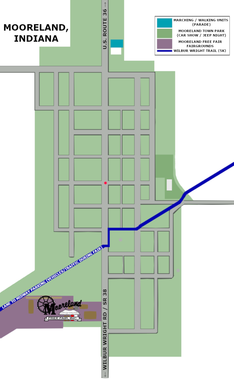
Mooreland Map (Fair Event Locations)

Mooreland Historical Society
* Located on the North End of Town on Broad Street.* Marching and Walking Units for the Parade Will Meet Here.
* Free Little Library
Mooreland Town Park
* Located on the East Side of Town at the End of Charles Street.* Car Show & Jeep Night are Located Here.
* Concessions and 50/50 In The Shelter House.
* Playground Equipment, Shelter House, Basketball Court, Shade, Wilbur Wright Trail Access.
Wilbur Wright Trail
* Connects Mooreland Fairgrounds & Mooreland Town Park.* The 5K Run & Walk Course is on the Trail.
* Follow the Trail to Fair Events Off the Midway!
**Please note that on the west side of Broad Street, Wilbur Wright Trail turns into the lane back to our midway parking lot and there WILL be vehicles and traffic on that end of the trail during the week of the fair.**


